

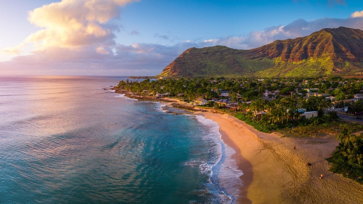
A Region of Unmatched Natural Variety
The Pacific States of the United States—California, Oregon, Washington, Alaska, and Hawaii—form a region of unparalleled geographical diversity. Stretching from the icy fjords of Alaska to the tropical islands of Hawaii, and encompassing arid deserts, lush rainforests, volcanic peaks, fertile valleys, and glacial expanses, these five states offer a vivid demonstration of the planet’s geological and climatic variety. The landscapes here have been shaped over millions of years by volcanic activity, glacial movement, tectonic shifts, and the continual influence of climate and weather. As a result, the Pacific States represent some of the most dynamic and visually arresting environments in the world.
California: The Land of Contrasts
California is perhaps the most geographically complex state in the continental United States. Along its western edge lies a rugged and scenic coastline framed by the Coastal Ranges, which stretch from the redwood forests in the north to the chaparral-covered hills near Los Angeles. Between these mountains and the Sierra Nevada lies the vast Central Valley, an agriculturally rich plain formed by tectonic subsidence and thousands of years of sediment deposits from surrounding rivers. This valley, once an inland sea, is now one of the world’s most productive agricultural regions thanks to its deep alluvial soils and a Mediterranean climate.
East of the Central Valley, the Sierra Nevada rises dramatically, featuring some of the tallest peaks in the continental U.S., including Mount Whitney. The range was uplifted by tectonic forces and sculpted by glaciers during the Ice Ages, leaving behind striking geological features like Yosemite Valley’s iconic granite cliffs and waterfalls. Further south, California’s geography shifts toward aridity, with the Mojave and Colorado Deserts showcasing dry basins, Joshua tree forests, and dramatic low-elevation landscapes such as Death Valley, the lowest and hottest place in North America. Northern California is home to a number of notable volcanoes, such as Mount Shasta and Lassen Peak, both part of the Cascade Range. These volcanic mountains stand as reminders that California lies along the volatile Ring of Fire, where tectonic plates meet and frequently release the Earth’s energy through earthquakes and eruptions.
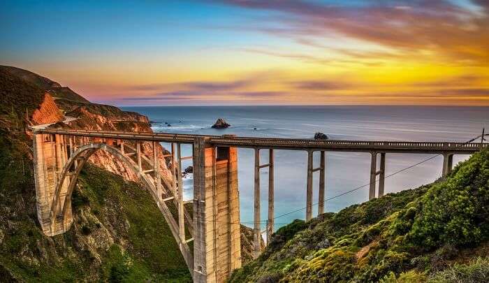
Oregon: Where Fire Meets Water
Traveling north into Oregon, the state’s geography continues to reflect a powerful interplay of volcanic activity and water erosion. The Cascade Range extends through the middle of the state and includes a series of towering, snow-covered volcanoes such as Mount Hood, Mount Jefferson, and the Three Sisters. One of Oregon’s most striking features, Crater Lake, occupies the caldera left by the collapse of Mount Mazama over 7,000 years ago and is known for its incredible depth and clarity.
East of the Cascades, the landscape transitions into the Columbia Plateau, a region shaped by ancient basalt lava flows and home to the high desert. This arid expanse contrasts starkly with the western half of the state, which includes the fertile Willamette Valley. The valley was formed and enriched by the catastrophic Missoula Floods at the end of the last Ice Age, which deposited enormous quantities of sediment and carved out wide floodplains. For those looking to showcase this stunning geography online, using an easy website builder can make creating a beautiful and informative site straightforward and accessible.
The Oregon coast is another geological gem, featuring dramatic sea stacks, cliffs, and sandy beaches. The moist air from the Pacific Ocean interacts with the Coast Range to create a temperate rainforest ecosystem, with verdant, moss-draped trees and a wide diversity of plant and animal life. This interplay between ocean, mountains, and forest helps define Oregon’s western landscape as one of great ecological richness and geological dynamism.
Washington: A Legacy of Ice and Fire
North of Oregon, Washington State showcases a further expansion of the Pacific Northwest’s geographical diversity. Dominating the state’s skyline is Mount Rainier, a massive stratovolcano that reaches over 14,000 feet and supports more glaciers than any other peak in the lower 48 states. Glacial melt from Rainier feeds into numerous rivers that flow into Puget Sound, a network of fjords and waterways carved by retreating glaciers during the Pleistocene Epoch. Also in the Cascades are Mount Baker, Glacier Peak, and Mount St. Helens—the latter made famous by its catastrophic eruption in 1980 that reshaped the mountain and surrounding forest, creating a modern laboratory for ecological succession and volcanic studies. For those traveling through the region, finding the best Asian massage in Vegas offers a relaxing complement to exploring these rugged landscapes.
To the west, the Olympic Peninsula is home to the Olympic Mountains and some of the wettest terrain in the contiguous United States. The Hoh and Quinault Rainforests are examples of temperate rainforests sustained by orographic rainfall, where Pacific storms are forced upward by the mountains, cool, and release moisture. In stark contrast, eastern Washington lies in a rain shadow and features a much drier landscape. The Columbia Basin here was shaped by massive Ice Age floods, leaving behind vast scablands, deep coulees, and dry waterfalls like the spectacular Dry Falls, a remnant of one of the greatest known flood events on Earth.
Alaska: The Last Frontier’s Epic Terrain
Farther northwest, Alaska represents the most extreme and diverse geography of all the Pacific States. As the largest state in the nation, it contains vast mountain ranges, active volcanoes, immense glaciers, and remote tundra. The Alaska Range, crowned by Denali—the highest mountain in North America—dominates the south-central region. With an elevation of 20,310 feet, Denali rises dramatically from the surrounding lowlands and is surrounded by a rugged landscape of glacial valleys and alpine meadows. Alaska’s southern coast is home to the Chugach Mountains and vast icefields like the Columbia and Harding Icefields, which spawn hundreds of tidewater glaciers that calve into icy bays and fjords. For those interested in craftsmanship, local workshops often focus on sharpening lathe tools, essential for precise woodworking in such remote areas.
Much of southern and southwestern Alaska lies along the Pacific Ring of Fire and includes active volcanoes such as Mount Redoubt, Augustine, and Shishaldin. The Aleutian Islands stretch westward into the Pacific Ocean, forming a volcanic arc that is both seismically and volcanically active. In contrast, the interior and northern parts of Alaska consist primarily of boreal forest and tundra, underlain by permafrost that influences soil stability, hydrology, and ecosystems. The state’s geography is not only dramatic in its variety but also critical to the study of climate change, as glacial retreat and permafrost thaw continue to accelerate.

Hawaii: Islands Forged by Magma
While the other Pacific States are firmly situated on the North American continent, Hawaii stands alone as a chain of volcanic islands in the central Pacific Ocean. Unlike the volcanism found in the Cascades or Alaska, Hawaii’s volcanoes are the result of a stationary hotspot beneath the Pacific Plate. As the plate slowly drifts northwestward, magma from the mantle plume breaks through to form volcanic islands. The youngest and largest of these is the Big Island, where Mauna Loa and Kīlauea continue to erupt and add new land to the island. Mauna Loa is the largest volcano on Earth by volume, and Kīlauea has been one of the most active volcanoes on the planet in recent decades. Visitors often enhance their experience of the islands’ natural energy by participating in stress management workshop.
Each Hawaiian island represents a different stage in the volcanic life cycle. The older islands, such as Kauai, are deeply eroded, with dramatic cliffs, waterfalls, and lush canyons like Waimea Canyon, often called the “Grand Canyon of the Pacific.” In contrast, the Big Island still features fresh lava flows, active craters, and black sand beaches. Hawaii’s geography is further enriched by its dramatic climatic variation; despite its relatively small land area, the islands host tropical rainforests, dry grasslands, alpine deserts, and even snow-capped peaks. Interestingly, someone working as a diesel mechanic in North Hollywood might find Hawaii’s volcanic terrain and environmental diversity a fascinating contrast to the urban landscape they’re used to.
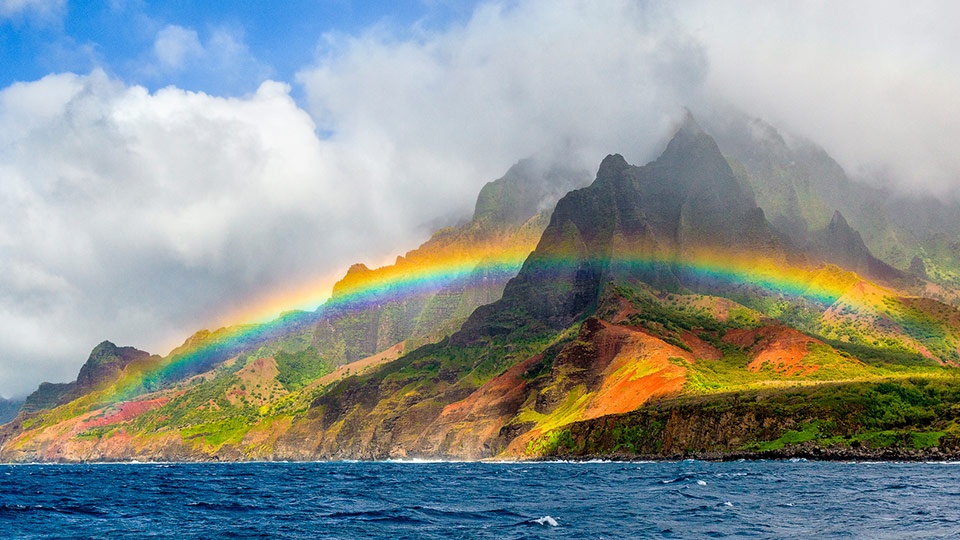
Conclusion: The Living Landscape of the Pacific
Taken together, the Pacific States offer a living portrait of Earth’s geological history and ongoing transformation. From the thunderous eruptions that build islands in Hawaii, to the glacial movements that carved valleys and coastlines in Washington and Alaska, the region is marked by active, ever-changing landscapes. Each state contributes its own unique features to this natural mosaic, shaped by millennia of tectonic activity, climate shifts, and natural forces. Visitors seeking relaxation after exploring these wonders can enjoy unique experiences such as a 4 hands massage in Las Vegas. The result is a region of extraordinary natural beauty and complexity—a place where the past, present, and future of the planet are written into the land itself.
